Introduction to GPS Technology
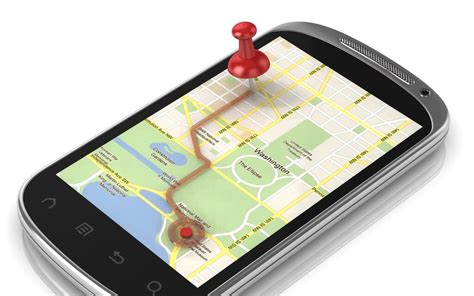
Global Positioning System (GPS) is a satellite-based navigation system that provides location and time information in all weather conditions, anywhere on or near the Earth. This technology has revolutionized the way we navigate, track, and explore our world. In this ultimate guide, we will dive deep into the world of GPS modules, their working principles, applications, and how to integrate them into your projects.
What is a GPS Module?
A GPS module is a device that receives signals from GPS satellites and calculates its position on Earth. It consists of a GPS receiver, an antenna, and a processing unit. The module communicates with a host device, such as a microcontroller or a computer, to provide location data.
How Does a GPS Module Work?
GPS modules work by receiving signals from a network of satellites orbiting the Earth. These satellites transmit radio signals containing their location and time information. The GPS module uses this information to calculate its distance from each satellite and determine its position through a process called trilateration.
Choosing the Right GPS Module
When selecting a GPS module for your project, consider the following factors:
-
Accuracy: The accuracy of a GPS module depends on factors such as the number of channels, the quality of the antenna, and the type of GPS receiver used. Higher-end modules offer better accuracy than lower-end ones.
-
Update Rate: The update rate refers to how frequently the module provides new location data. Faster update rates are essential for applications that require real-time tracking.
-
Power Consumption: GPS modules can be power-hungry, so consider the power requirements of the module and whether it is suitable for your project’s power budget.
-
Interface: GPS modules communicate with host devices through various interfaces such as UART, I2C, or SPI. Choose a module that is compatible with your project’s interface requirements.
Popular GPS Modules
| Module | Channels | Update Rate | Accuracy | Interface | Price Range |
|---|---|---|---|---|---|
| NEO-6M | 50 | 5 Hz | 2.5 m | UART | $10 – $20 |
| NEO-7M | 56 | 10 Hz | 2.0 m | UART | $20 – $30 |
| BN-880 | 66 | 10 Hz | 1.5 m | UART, I2C | $30 – $40 |
| SAM-M8Q | 72 | 10 Hz | 1.5 m | UART, I2C | $40 – $50 |

Interfacing GPS Modules with Microcontrollers
Hardware Connections
To interface a GPS module with a microcontroller, you need to make the following connections:
-
Connect the VCC pin of the GPS module to the 3.3V or 5V power supply of the microcontroller, depending on the module’s requirements.
-
Connect the GND pin of the GPS module to the ground of the microcontroller.
-
Connect the TX pin of the GPS module to the RX pin of the microcontroller’s UART interface.
-
Connect the RX pin of the GPS module to the TX pin of the microcontroller’s UART interface.
Software Configuration
To read data from the GPS module, you need to configure the microcontroller’s UART interface and parse the incoming NMEA sentences. NMEA (National Marine Electronics Association) is a standard protocol used by GPS modules to transmit location data.
Here’s an example code snippet in Arduino for parsing NMEA sentences:
#include <SoftwareSerial.h>

SoftwareSerial gpsSerial(10, 11); // RX, TX

void setup() {
  Serial.begin(9600);
  gpsSerial.begin(9600);
}

void loop() {
  if (gpsSerial.available()) {
    String data = gpsSerial.readStringUntil('\n');
    if (data.startsWith("$GPGGA")) {
      // Parse GPGGA sentence
      String latitude = parseField(data, 2);
      String longitude = parseField(data, 4);
      String altitude = parseField(data, 9);

      Serial.print("Latitude: ");
      Serial.println(latitude);
      Serial.print("Longitude: ");
      Serial.println(longitude);
      Serial.print("Altitude: ");
      Serial.println(altitude);
    }
  }
}

String parseField(String data, int index) {
  int found = 0;
  int strIndex[] = {0, -1};
  int maxIndex = data.length() - 1;

  for (int i = 0; i <= maxIndex && found <= index; i++) {
    if (data.charAt(i) == ',' || i == maxIndex) {
      found++;
      strIndex[0] = strIndex[1] + 1;
      strIndex[1] = (i == maxIndex) ? i+1 : i;
    }
  }
  return found > index ? data.substring(strIndex[0], strIndex[1]) : "";
}
In this example, we use the SoftwareSerial library to create a separate serial interface for the GPS module. The parseField function extracts the desired fields from the NMEA sentence based on their index.

Applications of GPS Modules
GPS modules find applications in various fields, including:
-
Navigation: GPS modules are widely used in navigation systems for vehicles, aircrafts, and ships.
-
Tracking: GPS modules enable real-time tracking of assets, vehicles, and personnel.
-
Geofencing: GPS modules can be used to create virtual boundaries and trigger actions when a device enters or leaves a specific area.
-
Robotics: GPS modules provide location information for autonomous robots and drones.
-
Weather Monitoring: GPS modules are used in weather balloons and buoys to collect location-specific weather data.

FAQ
-
Q: How accurate are GPS modules?
A: The accuracy of GPS modules varies depending on factors such as the number of channels, the quality of the antenna, and the type of GPS receiver used. High-end modules can achieve an accuracy of 1-2 meters, while lower-end modules may have an accuracy of 5-10 meters. -
Q: Can GPS modules work indoors?
A: GPS modules rely on signals from satellites, which can be blocked by walls and other obstacles. As a result, GPS modules may not work reliably indoors or in areas with poor satellite visibility. -
Q: How often do GPS modules update their location?
A: The update rate of GPS modules varies depending on the specific module and its configuration. Typical update rates range from 1 Hz to 10 Hz, meaning the module provides new location data every 1 to 0.1 seconds. -
Q: Can GPS modules be used for altitude measurement?
A: Yes, GPS modules can provide altitude information along with latitude and longitude. However, the accuracy of altitude measurements is generally lower than that of horizontal position measurements. -
Q: Are GPS modules affected by weather conditions?
A: GPS modules can be affected by severe weather conditions such as heavy rain, snow, or thunderstorms. These conditions can weaken or block the satellite signals, reducing the accuracy and reliability of the GPS module.
Conclusion
GPS modules are powerful tools for adding location awareness to your projects. By understanding their working principles, choosing the right module, and properly interfacing them with microcontrollers, you can unlock a wide range of applications. Whether you’re building a navigation system, a tracking device, or an autonomous robot, GPS modules provide the essential location data you need.
As you explore the world of GPS modules, keep in mind the factors that affect their performance, such as accuracy, update rate, power consumption, and interface compatibility. With the right knowledge and tools, you can harness the power of GPS technology and create innovative projects that push the boundaries of what’s possible.
Leave a Reply